![]()
03-WCS and QGIS
QGIS is a poplular open-source desktop-based Geographical Information System that bases on the collaboration and development of people within the geospatial data community. Based on individual plugins, QGIS can be enriched with a wide range of additional functionalities.
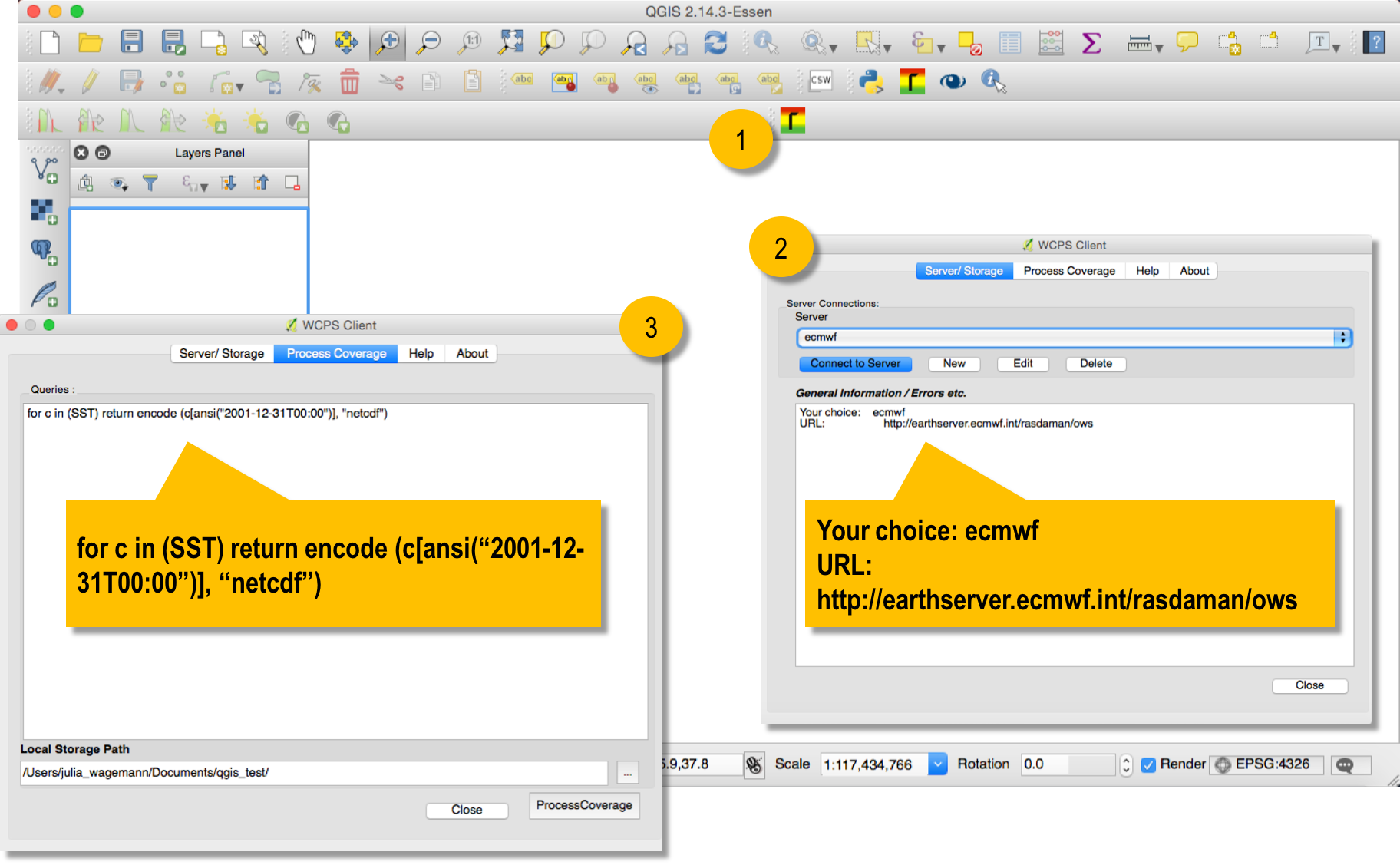
Per default, QGIS can be used as a WCS 1.1.1.1 compliant data server. ECMWF's WCS server is compliant to WCS 2.0 and gladly, there is a QGIS plugin that can be installed to be also compliant to WCS 2.0. Thapaliya & Misev (2014) built the QgsWcpsClient1 plugin, which allows to connect to a OGC WC(P)S server and to execute a WCPS query for direct import to QGIS. Figure below shows an example of a WCPS query executed in QGIS to retrieve sea surface temperature data from ECMWF for 31 December 2001.
A connection can be made either to ECMWF's service endpoint or to any other WCS 2.0 server. Further service endpoints are:
- Planetserver: http://access.planetserver.eu:8080/rasdaman/ows
- EO Data Service: http://eodataservice.org/rasdaman/ows
- Marine Data Service: http://earthserver.pml.ac.uk/rasdaman/ows
Once the connection is established, data on the server can be accessed via a WCPS query. Figure below shows (1) data from the Plymouth Marine Laboratory, the the marine science data provider of EarthServer-2 and (2) ERA-interim sea surface temperature from ECMWF.

WCPS queries can do complex calculations on-the-fly. Figure below shows two examples, how a false-colour composite of the planet MARS and a calculated NDVI from the Landsat8 satellite can be loaded on-the-fly into QGIS for further processing.

